For an average residential lot a plan is relatively straightforward particularly if there are no Heritage Trees on the site (Diameter at breast height greater than or equal to 30 inches).
For more detailed plans with heritage trees, where mitigation or removals will take place, a site visit is required to estimate plan creation.
What’s involved in a typical plan:
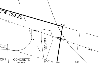
- Acquire spatial data for parcels, roads and right of ways from County GIS websites, a digital version of a recent parcel survey if available, satellite based or drone/UAS images.
- Pre-inspection setup of data such as infrastructure, data collection tasks and digital maps for devices.
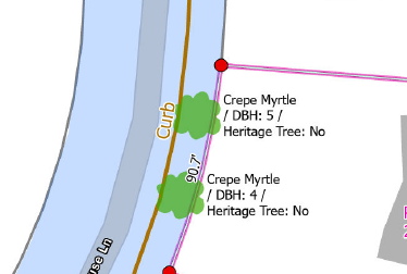
- Data collection including tree positioning, species ID and diameter, tree marking and classification (heritage trees, health).
- Spatial tree data plan draft creation.
- Revise draft as necessary.
- Submit final plan.
We can assist with complex spatial plans such as for multi-unit developments. In some cases a plan requires ongoing monitoring and updating of tree and mitigation data to include analytical derivatives for tree canopy. For such projects we offer the digital infrastructure for a living and breathing spatial plan which you ca update and which will meet development and permitting requirements.
Reach out to us at info@oaspatial.com to talk to us about your project needs.
Note, we don’t currently provide arborists services to evaluate tree health, recommend species for sites, treat trees, prune trees or cut them down. However, we can work with an arborists as needed.